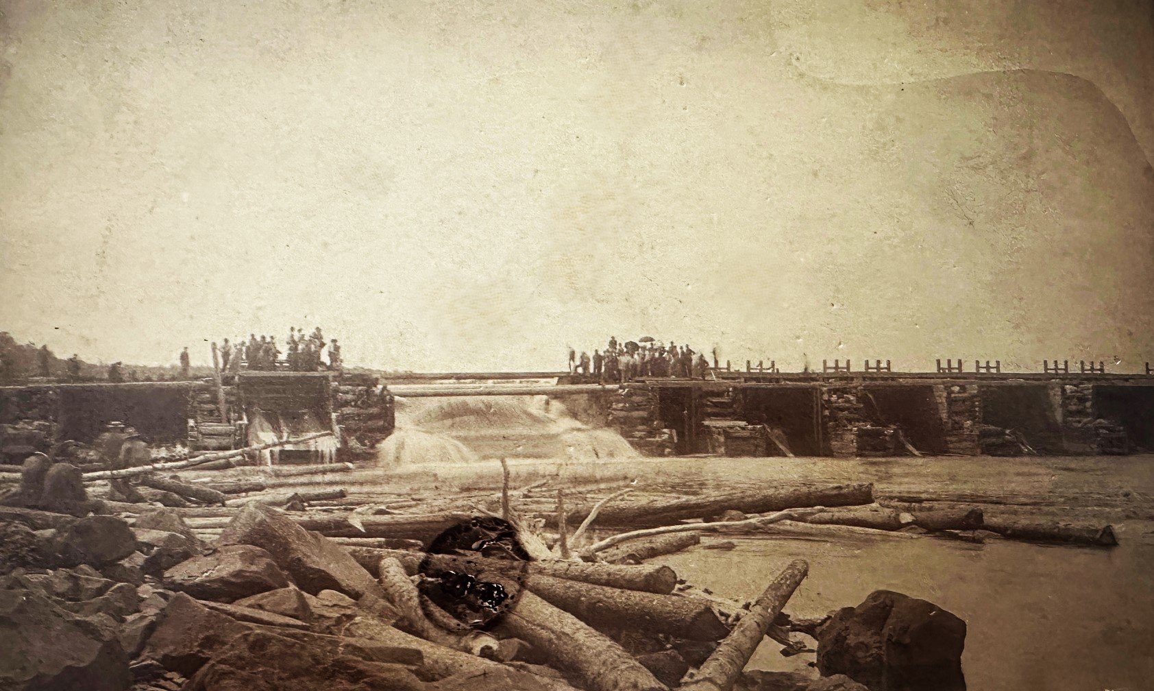

NEWLY FOUND RARE CROWE RIVER PHOTO
/We recently came into possession of this rare photo, probably dating back to 1890, of part of the original dam in Marmora. BUT DID YOU KNOW, the original dam, first built by Charles Hayes before 1826 to power his iron works, developed into a double dam that was set almost perpendicular to the modern dam.
But it looks long, you’re thinking.
And it was long! Looking at the Hayes 1826 map, we can see the placement of the more northerly dam, the original (one and only) Marmora bridge further north, and St. Matilda’s Church. The scale on his map shows the dam to be over 2 chains or about 150 feet. The Village Compiled Plan 307 (1901) indicates the placement of the second, more southerly, dam and also confirms the northerly dam to be over 2 chains, if you compare a lot size with the dam length.
1826 map of the charles hayes ironworks, the original bridge and first dam
Compiled plan 307 for the village of marmora, dated 1901
The yellow lines on this Doug Prindle aerial view of today’s dam, indicate the approximate placement of the original twin dams,
Below left: A later photo of this dam clearly shows St. Matilda’s Church ruins in the background, dating this photo to about 1920.
Below right: the southern dam , which ran almost parallel to Main street., with Pearce mills and Marmora Presbertyrian church in the background c.1890
c. 1920 with ruins of st. Matilda in the background
southern dam, c.1890