NORTH TO SOUTH
Another great video by Sean Scally
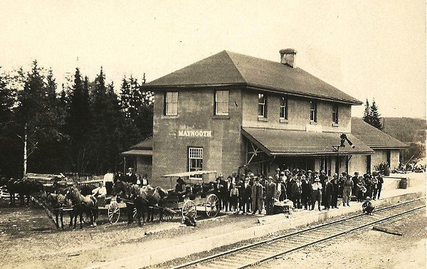
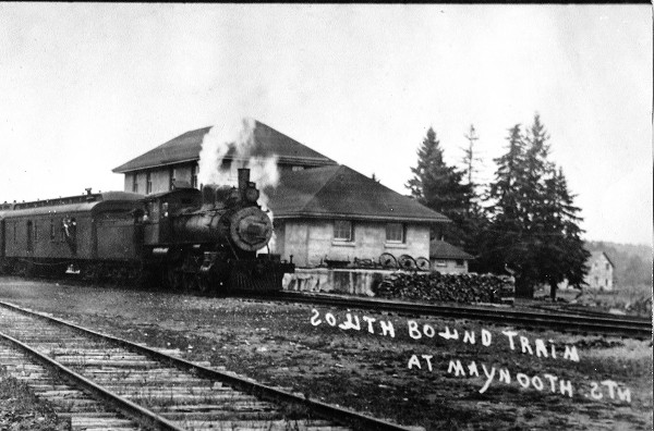
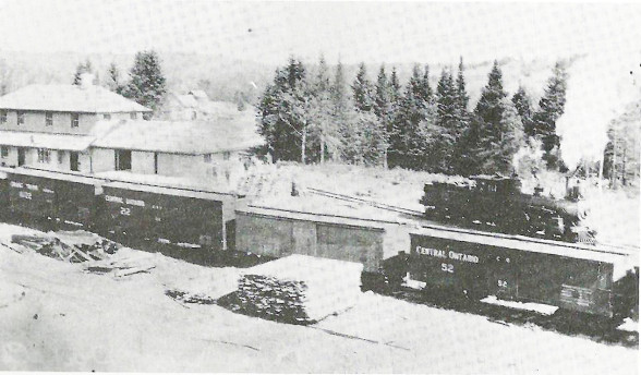
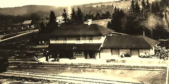
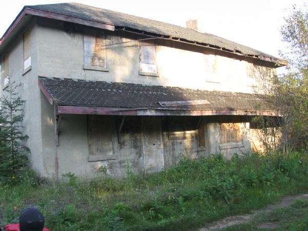
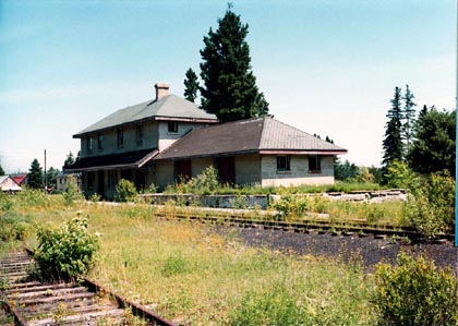
Maynooth (1907)
The first poured concrete station in Ontario
No picture for Hybla . By the 1950's the Hybla station was moved to become a part of a family's home. The rails were lifted in the 1980's.
No picture for Bird's Creek, but above is pictured the spur line to Baptiste Village.
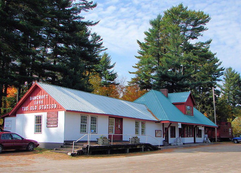
Bancroft(1900)
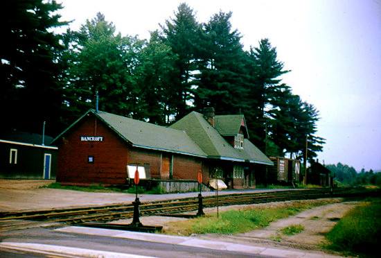
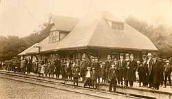
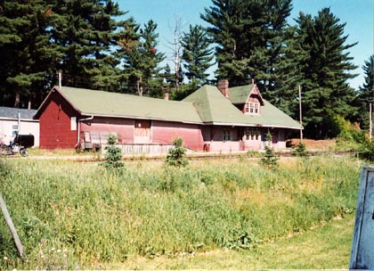
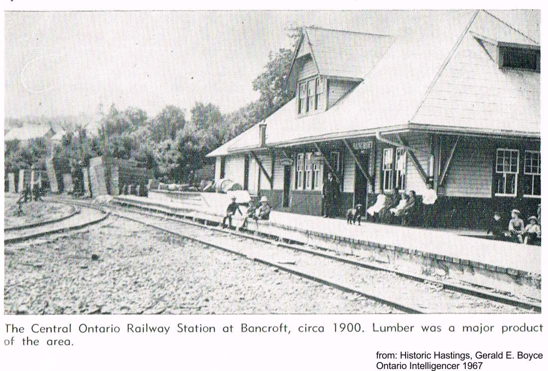
This commodious station has been jacked up on its original location to provide for a new and lasting foundation. The station consists of a former large general waiting room (now the local chamber of commerce office), the former agent's office (now the reception area), and a substantial baggage/freight room that now houses the Bancroft Gem & Mineral Club Mineral Museum, art gallery & visitor centre
Bancroft heading north 1959 special excursion of the Upper Canada Railway Society and the Canadian Railroad historic Association Association Basil Headford photo Jacob Patterson collection
The round structure above is a water tank (required for the steam engines) , similar to the one that was in Marmora. Note that the rod on the top is NOT a lightening rod, but an indicator of the level of water in the tank.
April 7, 2024, location of Bronson Station, Bronson Road, L'Amable Ontario Photo sent by Catharine Smallwood Seidenbusch
No picture of Bronson (1900) which was moved to property on Maxwell Settlement Rd. at Hwy. #62 (Frame storage shed)
Catharine Smallwood wrote: “I grew up north of Bronson station on Bronson Rd, L'Amable; there are still ruins 2024 at the rail line , south east side of the rec trail/ old rail line, very disintegrated wooden slats pile, still beautiful.”
L'Amable (Detlor) where the Bessemer branch led to the ChildsIron Mine opened in 1906
Turiff - no remains
Brinklow Station east of the corner ofHwys. 62 & 620 No photo
A spur line to Ormsby a.k.a. Coe Hill Junction was built in 1884 to service the newly opened iron ore mines. Coe Hill was named after William Coe of Madoc. He formed the Coe Hill Mines Company, after Harry Johnson had discovered iron deposits in a hill.
Coe Hill became a principal shipping point for the giant Rathburn Lumber Company. As many as 100 teams a day came with loads ready to be shipped south on the Central Ontario Railway.
The station was moved to Fairgrounds and isused for offices and concession stand
Ormsby (a.k.a. Rathbun) 1930 with Jean Park
St Ola Station (1884) with train in 1925
THE CENTRAL ONTARIO RAILWAY
MAYNOOTH TO PICTON
(Wikipedia) The opening of Central Ontario during the 19th Century was driven primarily by the discovery of a number of mineral deposits, notably gold and iron ore. As mines grew, principally in the area of Marmora and Madoc, a race formed between a series of railway companies which wanted to serve these markets. Among the many claimants were the Victoria Railway (VicR) that ran through Lindsay, a combined rail and water route by the Cobourg and Peterborough Railway (C&P), and a potential extension of the Toronto and Nipissing Railway. None of these were well placed though, as they ran towards Toronto instead of east to the major markets and shipping routes. The only line that appeared to be well positioned was a proposed branch of the Grand Junction Railway (GJR) out of Belleville. Since the new mining areas were directly north of both Trenton and Belleville, the Prince Edward Railway Co. was also in an ideal location as a starting point.
William Coe of Madoc found iron ore deposits outside Brinklow and began looking for ways to commercialize the find. He contacted George William McMullen, a railway promoter in Chicago who had been born and raised in Picton. McMullen started looking for partners, and found Samuel Ritchey, a businessman from Ohio who was looking for new ventures. Ritchey, McMullen and McMullen's brother J.B. bought the Prince Edward Railway Co. in 1880 to serve as the basis for a rapid expansion. In 1881 the group purchased 70,000 acres of land for the mines, and transferred the deeds to the company. The group then petitioned the Ontario Legislature for the rights to rename the company and start construction northward, which was granted on 10 March 1882. The land deeds were transferred to the newly formed Coe Hill Mining Company, and the railway was renamed the Central Ontario Railway.
The route was selected to take the line through several other mining areas, including Marmora, Deloro and Malone, before reaching Eldorado. The line reached Marmora in 1882 and the newly formed Coe Hill in 1884. The first load of ore left the Coe Hill station on 2 June 1884,but when the samples reached Cleveland for analysis the results showed that the ore was too low grade to be useful for mining, leaving the company on the verge of bankruptcy.
In his book, "In Search of the Grand Trunk - Ghost Rail Lines in Ontario" (2011), Ron Brown outlines the end of the Central Ontario Railway.
"Before long, the mining branches began to fall victim to dwindling deposits. The Cordova branch was gone by 1941, the line north from Maynooth to Wallace ended in 1965, that to the Childs Mine the same year, and the Coe Hill branch the year after. The main route to Bancroft and Maynooth managed to keep going until 1985, when it, along with everything north of Trenton, fell silent."
1965
In reference to St. Ola Station, John Brett McGeachie wrote in 1988, "In 1885, the three Mawson brothers, John, Mark and Tom, who had emigrated from Yorkshire, joined the brushing gang, clearing the right-of-way to extend the Central Ontario Railway from Bannockburn to Coe Hill. With the arrival of the work gangs, Sidamer Steenburg built a bunkhouse to board the workmen. When this section of the railway was completed in 1886, the mail was transferred from the Hastings Road Stage Coach to the railway, and Steenburg opened a post office and general store in the vacant bunkhouse. Mark Mawson became section foreman of the work gang that maintained the tracks and road bed.
Gilmour a remote logging community. Today, it has become a modern rural community with newer homes lining the Weslemkoon Lake Road. The station lasted until the1980s. The hotel still stands beside the trail, now a private home.
MORTON KLINE BAKER - GILMOUR TELEGRAPH OPERATOR
Morton Kline Baker died at his home at Gilmour early Wednesday morning, He was failing in health for several years. Born at St. Ola, the late Mr. Baker was a son of Mr. and Mrs. Joseph Bake:- His father died some time ago. He was in his 59th year and all his life was spent in the district. He was a capable and reliable telegraph operator in the employ of the Canadian National Railways at Gilmour and served continuously from March 17. 1913, until he retired owing to ill health on July 6th, 1913. Surviving him are his wife, the former Bernice McCoy; one sister, Mrs. Estell Arkell, Eldorado. North Hastings Review, Madoc, April 20 1950
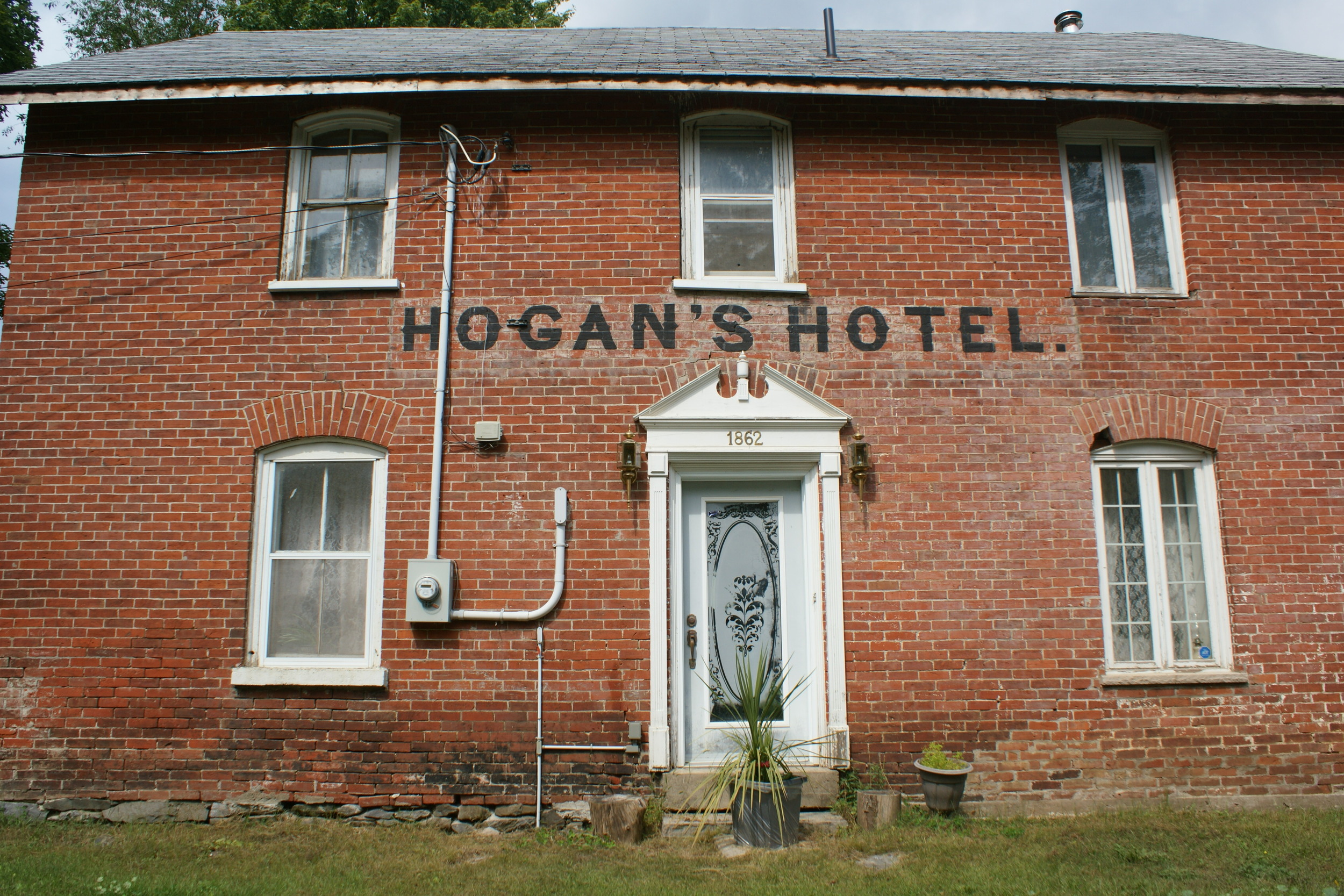
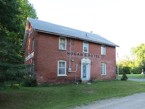
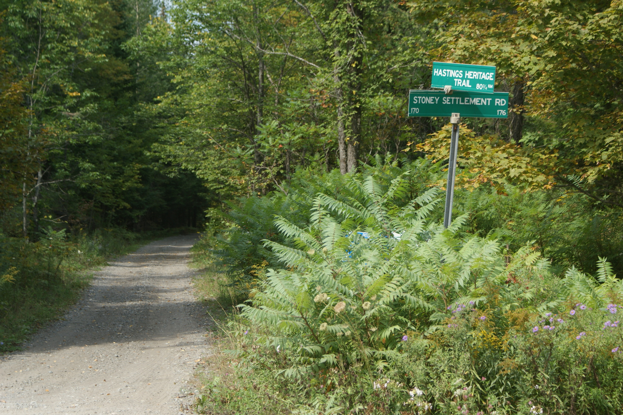
Millbridge - The mill village of Millbridge lays on the Hastings Road and is now a ghostly remnant of its pioneer days. Located where the tracks of the COR are, a few kilometres to the east, Millbridge Station never developed into a village but offers one of the more striking trail-heritage sights. Here, the former Hogan's Hotel was built to serve travellers planning to travel the Hastings Road. This large brick hotel seems strangely out of place in the woods that surround it. Both it and the trail lie east of Highway 62 on the Stony Settlement Road. (Ron Brown)
bed from the Hogan Hotel & Cooper, ggg-grandchild of Denis Hogan
From Ontario Ghost Towns “The arrival of the Central Ontario Railway (COR) in 1883 led to the establishment of a small satellite village a few kilometres east of Millbridge, near the site of the popular Hogan's Hotel. The hotel, which predated the railways, was built by Dennis Hogan in the 1860s. Today it easily remains the most visible reminder of the days when trains regularly stopped at Millbridge Station and the railway reigned supreme. In addition to the station, the settlement contained a store and a few cabins. In 1900 Hogan opened a post office and for a while the community was known as Hogan's PO or simply Hogan. “
Dennis Hogan was convinced that a train would be running through the area. It took four years to haul brick from Belleville with a team and wagon to the construction site. James, his son, made all of those trips to Belleville with his father. The Hotel is privately owned today and still stands with it’s original signage.
Bannockburn - Originally called Mumby's Mills, named after William Mumby who built the first grist mill around 1860. It also had a saw mill and experienced a small gold rush in 1889. Nothing remains of this station which stood on "Station Road", although one source claims it was moved to the main street of Deloro, east side. It originally stood at the junction point of the COR and Bay of Quinte Railway. Apparently the two-stall engine house of the Bay of Quinte line remains, though it is located down a private lane, out of view of Station Road.
plan courtesy of the central hastings historical society
The Bay of Quinte railway,(looking east from station road) built by the Rathbun Lumber Co. to link Yarker to Queensborough and on to the Central Ontario Railway, capturing the miining market.
Eldorado
Ontario's first Gold Mine and the story of boom and bust - Only the platform remains of its flourishing railway days.
Below, the Eldorado hotel and Trading Post
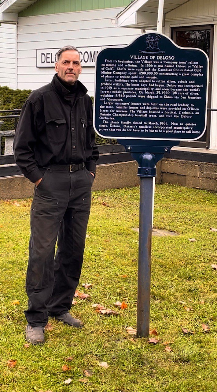
Malone- A village of three gold mines, yet nothing remains of the station except some logs of the retaining wall that held up the raised platform. Click here for more on Malone. Just north of the Marmora station was the spur line to Deloro, a village that made its mark on Canadian industrial history. Click here for the amazing story of Deloro
MARMORA
Marmora Herald, May 1907 - Deloro Spur Line
"A spur line is being surveyed from Marmora Station to C.O. Railway to Deloro. A road will be built on which to ship ore and coal."
GOING SOUTH FROM MARMORA
This 1947 map shows the abandoned mines in the Cordova Mines area. The the old rail line from Marmora is also visible.
Jonathan Leach wrote: Ontario, Belmont, and Northern railway, incorporated May 4 1891, then the COR consumed it oct 15 1909. Dec 20 1917, all railways were incorporated by the Govt and was Called CN railway. Abandoned 1940.
Click here to read all about Cordova and its mining days.
Excerpt from ““A Backward Glance” (A History of Stirling and area)
Looking south: CPR sectionmen pose for camera May 13, 1989 at the diamond. COR station served both railways at Bonarlaw. J.W.Heckman/Canadian Pacific photo credit: www.trainweb.org
Bonarlaw
Canadian Pacific RR Junction ] Famous for its "Diamond", the station was the hub of activity around the junction of two railway lines.
Click here to read all about Bonarlaw.
Former Canadian Northern station at Bonarlaw (Mile 24.98 Maynooth Sub.) was situated right at the diamond with the CPR (O&Q) old mainline (Mile 80.4 Havelock Sub.) and was used by both railways. Originally built for the Central Ontario, it finally became part of Canadian National Railways. The train is Trenton-Bancroft CNR Mixed 313 due at 9.05 a.m. on Friday August the 8th. 1958. Note the large sign leaning against the station advertising the Canadian National Exhibition in Toronto. Al Paterson photo credit: www.trainweb.org
Beautiful hand-made stone culvert installed by the C.O. Railway, still visible near the station. Photos submitted by Jonathon Leach.
Springbrook -
Excerpt from "The Heritage Years : A History of Stirling and District" (Pages 199-210)
Wellmans
(Rawdon Township 6th Concession) No photo
Anson Junction (Central Ontario Railway crossing)
(Named after a farmer, Anson Cummings) Just west of Stirling, this is a junction point of the COR and the Grand Junction Railway that linked Belleville & Peterborough. Directly to the east of the junction was Chard’s General Store.
June 3, 2023, Gord Young writes:
The "Anson Shed" was in use as a "clearance" for trains to cross after the station was lost. The Grand Junction/ RR/GTR/CNR, was considered "Superior", and,. the old Central Ontario RR the "Inferior".
Thus the COR engineer,, would have his head-end brakeman call Peterborough for clearance before going north or south before crossing.Quite a common practice on railways where a crossing was in a rather remote location. The shed was also used by Maintenance of Way men for their lunch or "tea--n-pee break".
Sincerely. Gord Young for Lakefield Heritage Research
This rare photo was provided by Jody Sager, a long time resident of Anson, and former CNR employee. He advises the agent (Tie and Hat ) is Frank Hutchinson (Wife was Hazel )
Jonathon Leach wrote: I was down at Anson this evening working with the metal detector. One of the neighbours came out asking what i was doing. We had a nice old chat and he told me he bought the property he’s on 2 years ago that backs onto the junction. He had told me the lady he bought it off was a life resident of Anson, and gave me this (see article below) she had left behind.
article circa 1971
Glen Ross
A 120 metre swing bridge was built to cross the Trent Canal, and now remains permanently open. The track, now a recreational trail changes name t this point. To the north it is the Hastings Heritage Trail, allowing motorized recreational vehicles; to the south it is known as the Lower Trent Trail, with its trail head office at the site of the Frankford Station, which has been relocated to Stockdale.
Frankford
This station now sits in Stockdale, however the foundation remain in Station Park, at the corner of Wellington and Miller Streets, just west of the Trent River
Glen Miller
This station was named Glen Millar, later spelled Glen Miller, in 1894. The community is situated in a glen and is believed to have been named after Alexander Miller, a mill builder who retired here. (There is a side trail at this point that leads to the famous Bleasdell Boulder.
Trenton Junction (junction with the Grand Trunk Railway) followed by Trenton
From this point, the railway was originally built as the Prince Edward County Railway. There were nine more stations on the line going south from Trenton to Picton: Now the millenium Trail, the rail bed offers hikers & bikers a direct route from Trenton to Picton.
CLICK HERE FOR MORE ABOUT THE MILLENIUM TRAIL
Canal, Weller's Bay, Consecon, Hillier,
Consecon, Aug. 1989 - Demolished in 2000
The rail bed near Hillier The trail at Hillier’s Station Road is flanked by lilacs, green in this photo, but alive with colour and fragrance in late May photo by Terry Sprague (2005)
Niles Corners, Wellington, Hallowell (1879 frame construction - relocated to Stanley St. outside Bloomfield for a children's playhouse),
Bloomfield-(right) Frame construction 1879 - moved to the east side of West Lake for a private residence.
Picton - Brick construction, moved to 56 Main St. for Evans Lumber Co. in the '70sThey write: "The shopfront gives no clue to the property's history, but a walk around the back shows the long low lines of the Victorian railway station.
Krista's office is the old telegrapher's office overlooking the space where the tracks once ran. The tracks are gone, but the big railway storage shed remains. The space where tons of corn, coal and crates were stored is now filled to the rafters with lumber.
And what rafters they are. The building was constructed about 1909 and the massive wooden trusses and great hefty bolts proudly show their age. "It's the original roof," says Tom. "Still in great shape." Train buffs visit regularly to admire features like the floor of the loft in the big shed, made from reclaimed railway car siding complete with stencilled CN numbers. There's a huge steel safe in the offices, too, a walk-in stronghold with a heavy iron door and worn combination lock.
The 1980 Canadian Rail newsletter summed up the Central Ontario Railroad craze in its review of a book by Plomer and Capon - "Desperate Venture - Central Ontario Railway (1979 Mika Publications)
"Like many rural railway undertakings of the period (1880-1900), the COR's aspirations were great, but the trials and tribulations of its genesis on a narrow financial base were greater. The hopes of its supporters bounded and rebounded as connections were made with the young adult Grand Trunk at Trenton Junction, the penurious Grand Junction at Anson Junction, the Canadian Pacific's Ontario and Quebec at Bonarlaw and the consumptive Irondale, Bancroft and Ottawa at York River Junction, 2.5 miles north of Bancroft.
As the poet says 'The course of true love never did run smooth'. In spite of all the blandishments that the Central Ontario offered, the other railways that would, couldn't, and the ones that could, wouldn't. The Grand Trunk Railway treated the Central Ontario like a "no-no"; the Ontario & Quebec was too busy beating the Grand Trunk at its own game between the Detroit River/St. Clair River gateway and the east coast.
When hard times came, the Central Ontario consorted variously with the Midland Railway and the Ontario and Quebec. Finally, the Canadian Northern (Ontario) Railway, Mackenzie and Mann's prodigy, gobbled up the country bumpkin in 1909. The Central Ontario Railway Company, as a separate corporate entity, disappeared in 1914. The Canadian Northern, in turn, was swept willy-nilly into the omnium-gatheium carpetbag of the Canadian National Railway Company in the Flood Year of 1923."
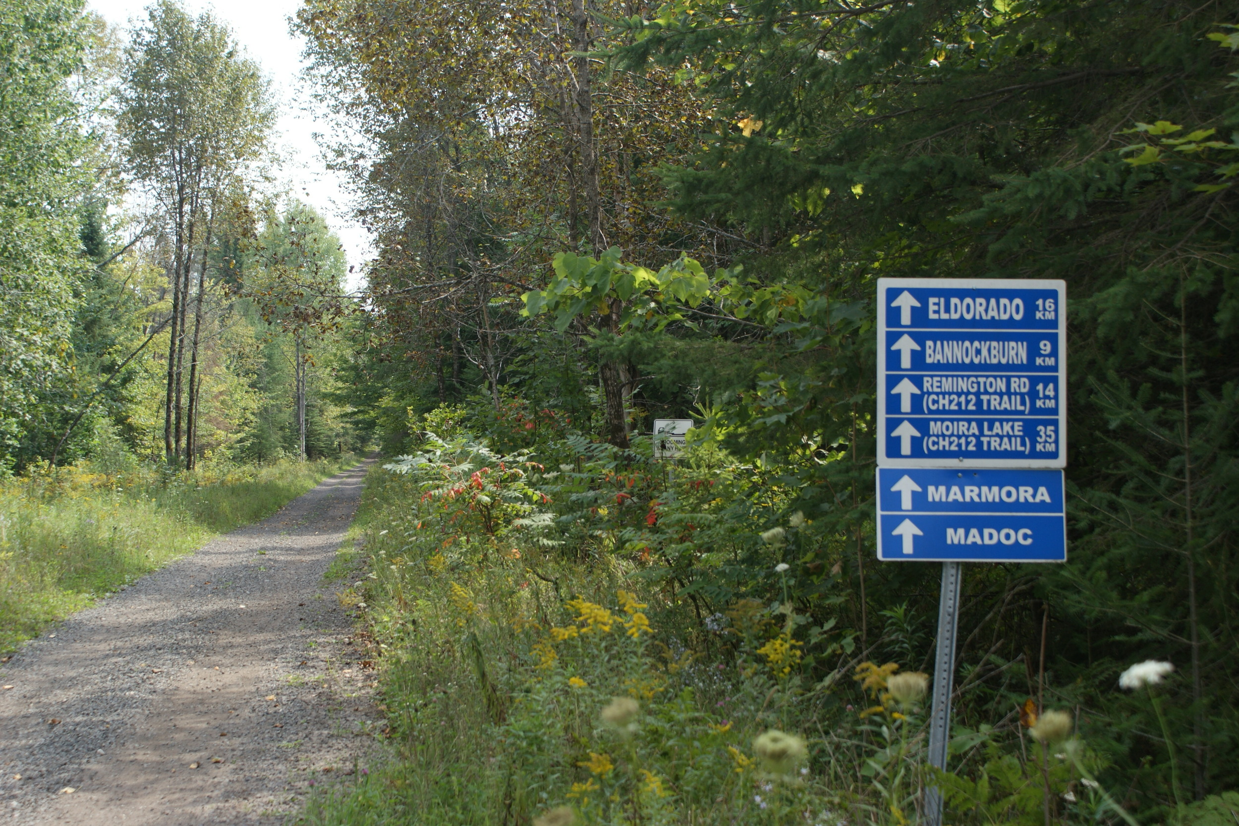
The line was completely abandoned in 1965 and now, as the "Hastings Heritage Trail". it forms a recreational corridor.
